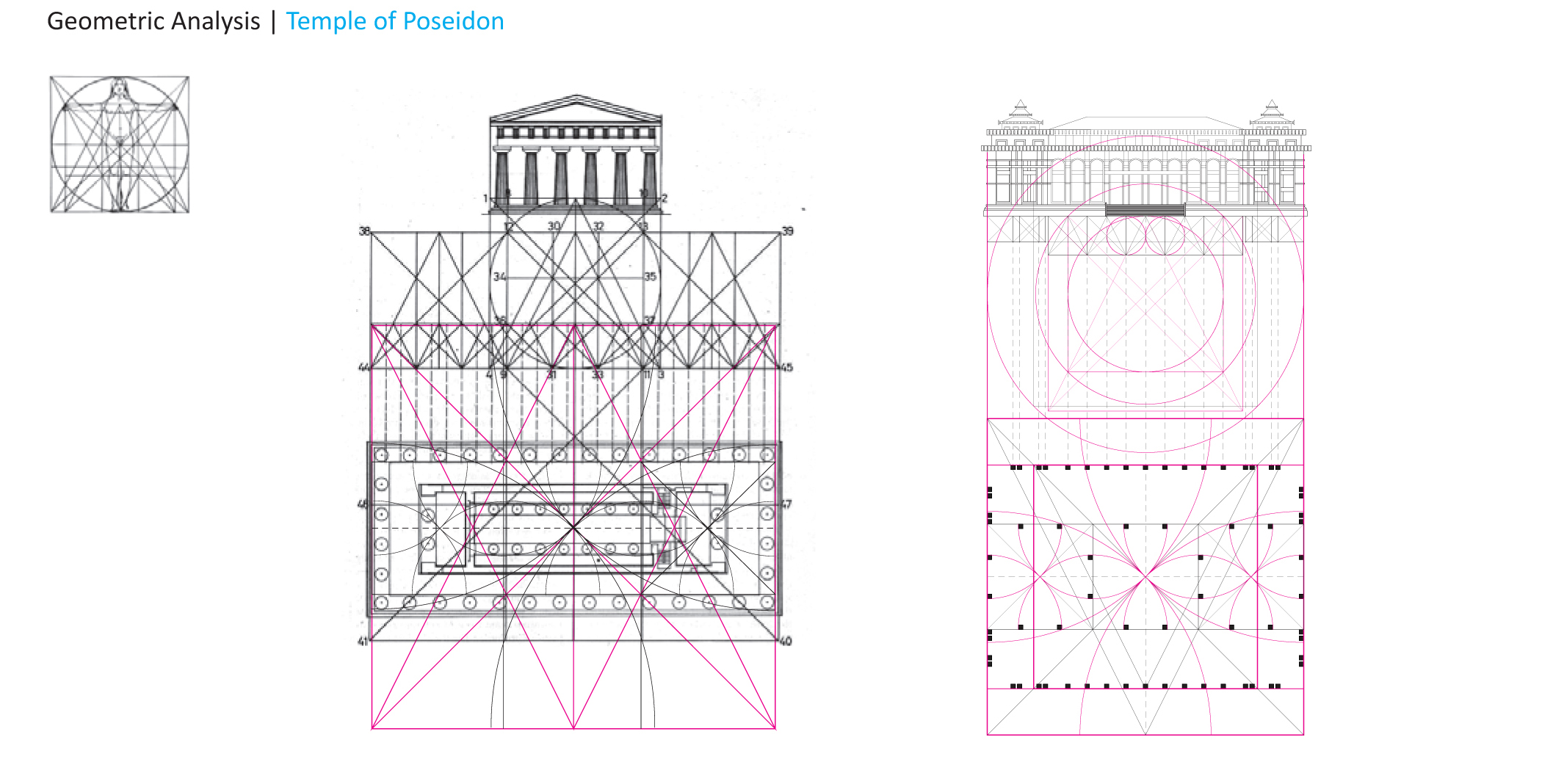
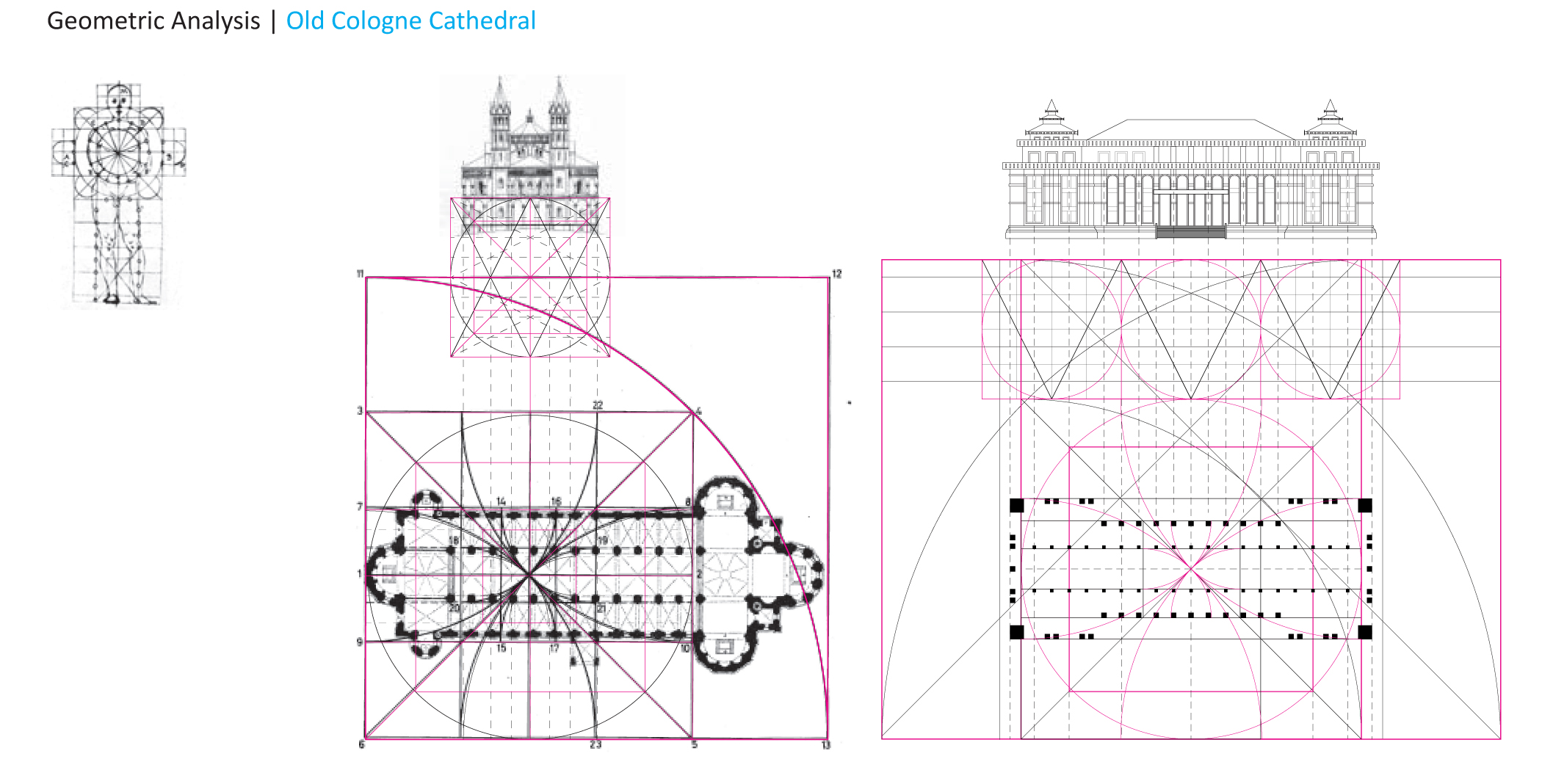
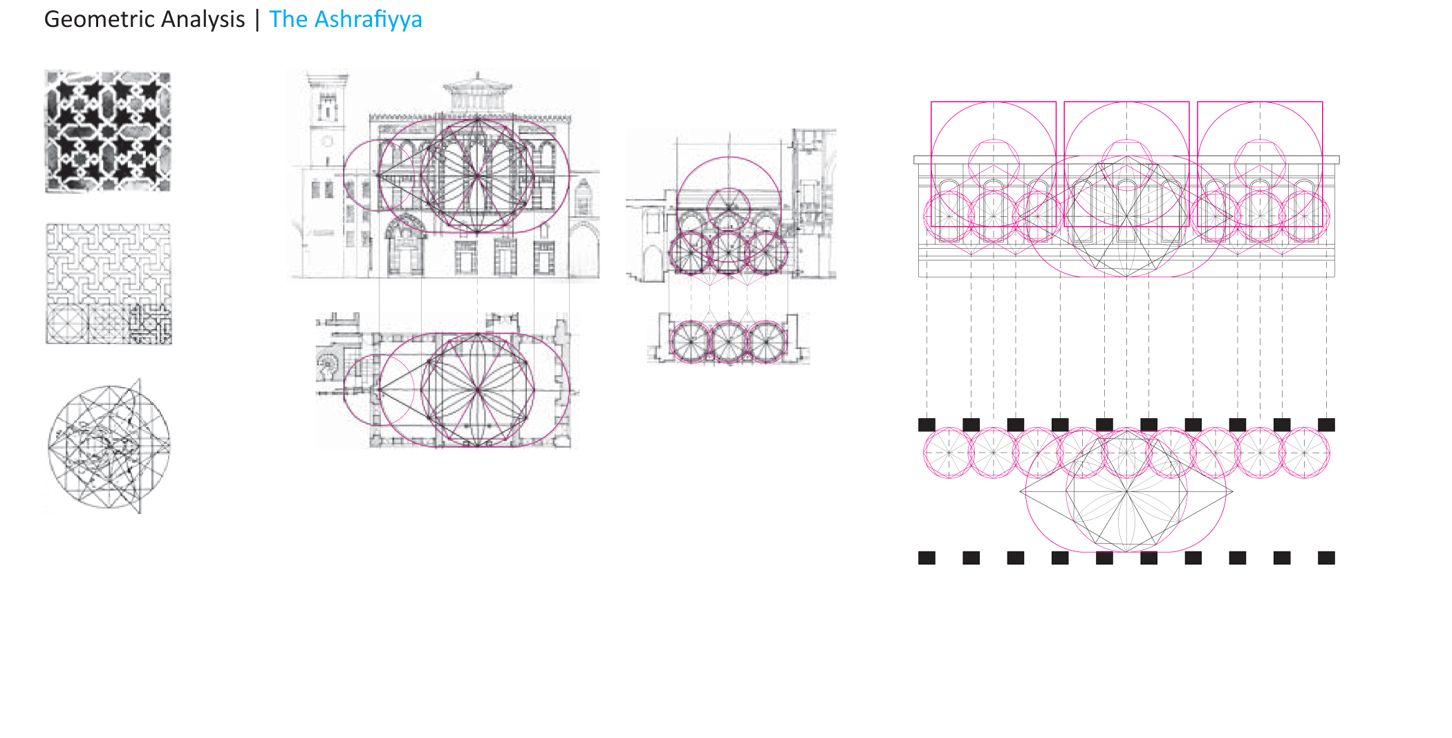
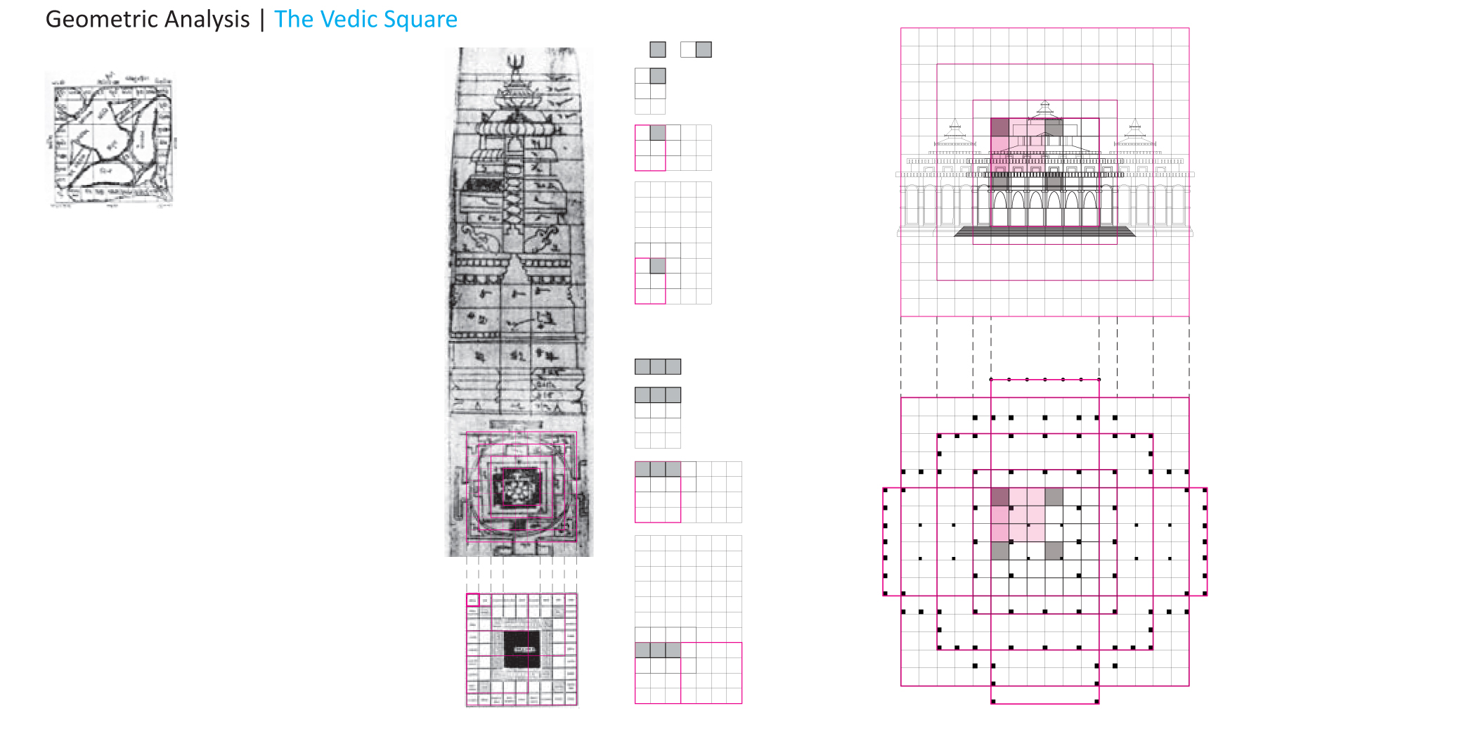
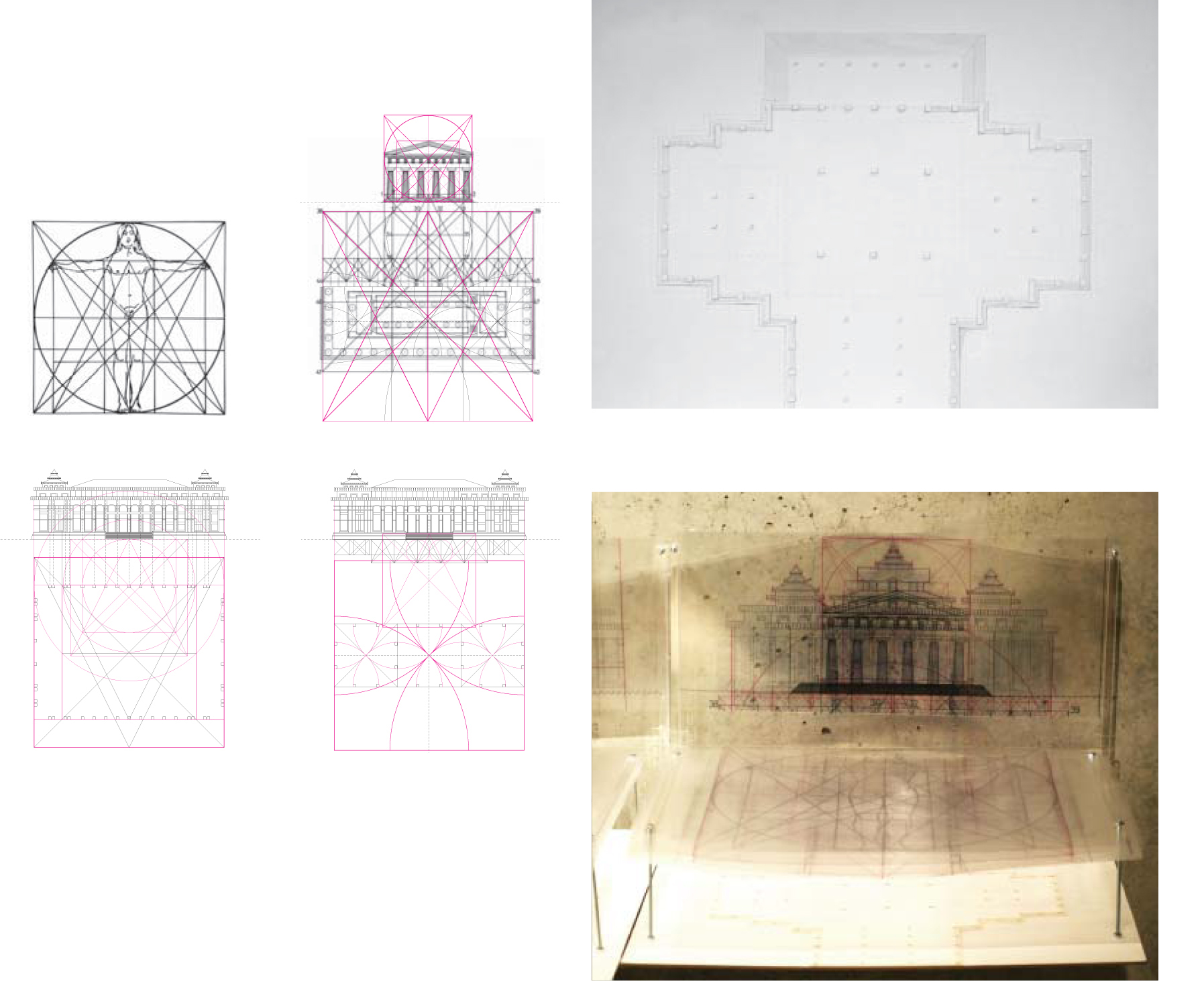
While photographs were initially the first way to understanding Nay Pyi Daw eventually a point came when a more rigorous analysis of the buildings was needed. However, questions soon arose on how to take loose snap shots and conform them to the traditional notion of what an architectural elevation is? How would one know what was truth and not distortion merely by looking at a photograph and creating an elevation from it? Certain facts are known, but many are still ambiguous. The complex nature of the building traditions being referenced on the façade of Nay Pyi Daw helped make the link between looking towards at first Greek geometric systems as a way to initially construct an elevation of Nay Pyi Daw. Greek geometric systems was initially the best starting point, not only because it is the best known geometric orderings system in Western architectural history, but it is also brings Nay Pyi Daw into a much larger building tradition of adopting Greek and Roman style architecture as a means to represent state Democratic architecture.
Four different geometries over lapped with the resulting elevations to show varying degrees of difference between all four elevations created.
Using four traditional geometric systems with specific buildings as reference points to systematically construct and building four different elevations, each with their own varying results and levels of truthfulness.
Each of these geometries used to create the various elevations are intrinsically coupled with a systematic way to create plans from that information. Four explorative plans were then generated by using the traditional geometries also used to create the elevations. These are four potential plans that could be a plan for Nay Pyi Daw if one chooses to view Nay Pyi Daw via one of these traditional geometries. Four layered diagrams were then created and over laid on top of a bas relief plan in order to show the various layers that were used in order to create these plans.
Gallery of Precedent geometries : click through
Temple of Poseidon precedent geometry with new plan for Parliament Building 1
Cologne Cathedral precedent geometry with new plan Parliament Building 1
Vedic precedent geometry with new plan for Main Parliament Building
Temple of Poseidon precedent geometry with new plan for Main Parliament Building


